![]() Back
to geophysics over the Southern Circle
Back
to geophysics over the Southern Circle
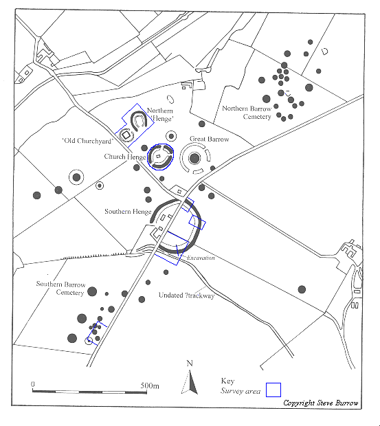
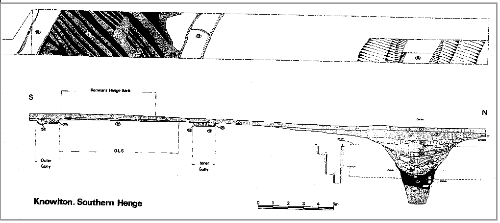
A trial excavation was carried out in the summer of 1994 across the bank and ditch of the south-east quadrant of the Southern Henge. This consisted of a 3m by 30m trench placed across an area previously surveyed using geophysics. The excavation was funded by English Heritage and aimed to assess the extent of plough damage across the monument and also to examine in more detail the form and history of the henge. In addition, the excavation was also used as an opportunity for photographer Pam White to capture something of the atmosphere of excavation that is often lost in academic reports
The henge bank was found to be heavily plough damaged, and in parts had been totally cut through. Although beneath its undisturbed portions a buried soil was found. At either end of the bank, and apparently marking its edges, two flat based gullies were identified. These gullies were 1.5m wide and 0.3m deep, and would appear to have been dug slightly before the construction of the henge, although the stratigraphy is unclear. Detailed study of the gradiometry plot for the site suggests these gullies extending for c22m. although due to the low resolution of the geophysical survey the possibility that they extend further around the henge cannot be ruled out.
A berm of 9.5m separated the henge ditch from the bank, and the ditch itself was found to be 5.5m deep, of which only 4.5m could be excavated at the time due to safety constraints. The remaining 1m was augered. Environmental samples were taken from the ditch fills, as well as from the gullies and old land surface. Full analysis of these sequences is pending. The fills of the ditch suggest that prior to its rapid erosion it had near vertical sides. The fills themselves contained three stabilisation, and/or slumping, episodes, and between the second and third of these two slot trenches were located. One of these contained wattle work whilst the other held posts. In the base of the latter slot trench was found a piece of worked chalk similar to that found at Wyke Down (Barrett et al 1991). It is unclear whether these features extended around the henge ditch or were part of a more localised feature. All enquiries regarding this work should be addressed to:
John Gale. (Email: jgale@bournemouth.ac.uk)
Steve Burrow. (Email: sburrow@bournemouth.ac.uk)