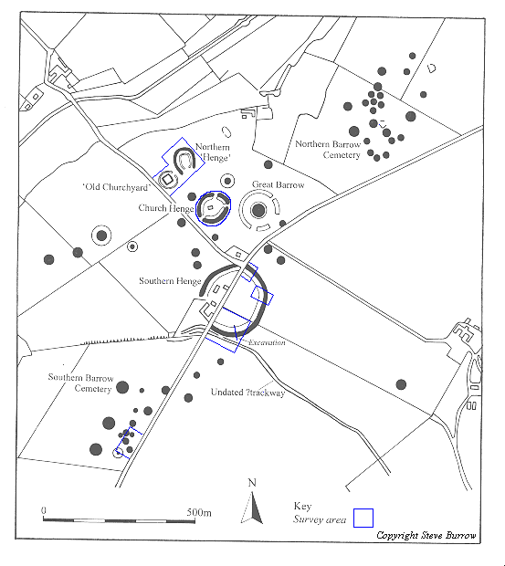
As part of the BSc programme of field archaeological tuition, it was decided to carry out a small scale survey over a portion of the Southern Barrow Cemetery at Knowlton in winter 1994.
The area selected was known from aerial photographs to contain a number of ring ditches of varying forms and size.
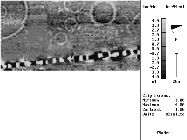
The survey was carried out by six students using both resistivity and gradiometry. The results of the resistivity survey were disappointing, and only the gradiometry resulted are noted here.
The results were marred by a high level of drift, which made difficult the interpretation of several subtle anomalies in the survey area. From a comparison of the survey results with aerial photographs it is however clear that the survey has located at least one ring ditch previously not known. It has also highlighted several inaccuracies in existing aerial photographic plots for the area. Perhaps the most tantalising feature within the survey area is however the linear anomaly intruding at the extreme left of the plot. It is hoped to be able to explore this feature more thoroughly in a further phase of work.
All enquiries regarding this work should be addressed to:
Steve Burrow. (Email: sburrow@bournemouth.ac.uk)