The survey work over the Southern Henge was commenced in October 1993 as a field survey project for Second year BSc archaeology students. A total of 15 students were involved in this first phase of work which was subsequently augmented by further survey in summer 1994. Initially it was decided to survey the south eastern quarter of the henge using resistivity, magnetic susceptibility, and gradiometry. In the event, the results provided by the resistivity work did not differ appreciably from the results of the gradiometry survey, whilst the magnetic susceptibility survey suffered from equipment faults. As a result, only the results of the gradiometry survey are outlined here.
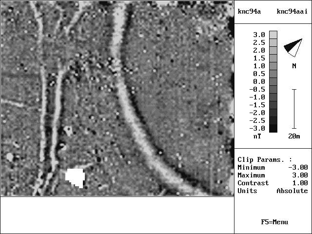
As can be seen, the technique worked extremely well over the chalk bedrock and successfully located the extent of the henge ditch, as well as a ditch network just to the south. Aerial photography shows this double ditched feature extending from the Allen valley past the Southern Henge to the hills southeast of the site. A scattering of iron spikes across the centre of the plot might indicate a frequently used accessway into the henge in more recent times. This scatter appears to broadly match a break-up of the ditch system. It is notable that the henge bank did not show on the geophysics results; presumably its matrix was not significantly different from that of the surrounding geology.
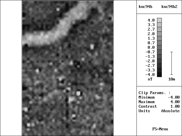
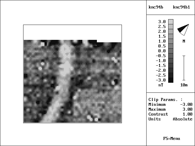
Further geophysics was carried out in the northeastern quarter of the henge monument in summer 1995. The aim was to assess claims that there may be an entrance in this area (Harding and Lee 1987), or that the current roadway might pass through an original entrance.
Neither survey located a gap in the ditch, although further work will be necessary to confirm that no such entrance is present. The sharp kink shown by the geophysics near the entranceway proposed by Harding and Lee provides further evidence to support the view of the Royal Commission (RCHM 1975, 113) that henge ditches were constructed in segments.
All enquiries regarding this work should be addressed to:
Steve Burrow. (Email: sburrow@bournemouth.ac.uk)