 The
Billown Quarry Site is clearly a major focus of prehistoric activity of many
different sorts over a long period of time. It should be noted, however, that
prior to excavation, the site looked just like any number of cultivated fields
in the Island. There were no visible earthworks, and while fieldwalking had
certainly brought to light some interesting pieces of worked flint neither the
range nor the density of material was exceptional. The excavations have revealed
a wealth of buried features, and moreover they are fairly well-preserved even
if flattened. How long they would remain in such good condition if ploughing
had continued is a more difficult question. Certainly the plough is cutting
into features at the north end of the site, but further south, where the soil
is generally thicker, only upward projecting deposits are being eroded at present.
Clearly there are implications here for all cultivated areas on the Island and
these will need to be taken into account with respect to preservation and excavation
policy in due course.
The
Billown Quarry Site is clearly a major focus of prehistoric activity of many
different sorts over a long period of time. It should be noted, however, that
prior to excavation, the site looked just like any number of cultivated fields
in the Island. There were no visible earthworks, and while fieldwalking had
certainly brought to light some interesting pieces of worked flint neither the
range nor the density of material was exceptional. The excavations have revealed
a wealth of buried features, and moreover they are fairly well-preserved even
if flattened. How long they would remain in such good condition if ploughing
had continued is a more difficult question. Certainly the plough is cutting
into features at the north end of the site, but further south, where the soil
is generally thicker, only upward projecting deposits are being eroded at present.
Clearly there are implications here for all cultivated areas on the Island and
these will need to be taken into account with respect to preservation and excavation
policy in due course.
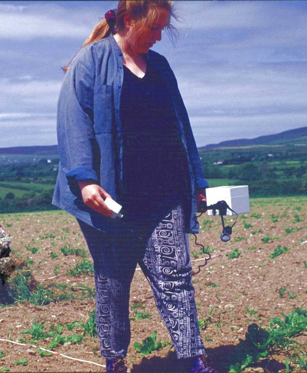 The
geophysical surveys illustrate the arbitrary nature of the sample of earlier
features obtained through excavations that are constrained by the land-take
of a particular current threat. But even the geophysical survey is partial.
Many features, including sections of Neolithic ditch, do not show on the geophysical
plots emphasizing the need for care when interpreting the plots and the importance
of testing the results (both positive and negative) through excavation wherever
possible.
The
geophysical surveys illustrate the arbitrary nature of the sample of earlier
features obtained through excavations that are constrained by the land-take
of a particular current threat. But even the geophysical survey is partial.
Many features, including sections of Neolithic ditch, do not show on the geophysical
plots emphasizing the need for care when interpreting the plots and the importance
of testing the results (both positive and negative) through excavation wherever
possible.
Over the next three or four years,
work within the Billown Neolithic Landscape Project will complete the total
excavation the Billown Quarry Site, sample through small-scale excavation
some of the features and structures in the vicinity of the site, including
some of those revealed by geophysical survey, continue the programme of
systematic reconnaissance-level geophysical survey working outwards from
the site, continue the programme of topographic surveys of nearby monuments,
and expand the environmental sampling of suitable deposits in the Silver
Burn and Dumb River catchments. Together, the results from these various
components of the overall Project will combine to provide a vivid insight
into the development of this small area of land and the people who lived
in it.