Archaeological
sites are recorded on the current coasts bordering the English Channel,
and are known to exist in the submerged area between. Undertaking
a detailed desk-based survey of the coastal areas, including recording
known submerged sites, finds and features, will provide a comprehensive
listing of the known archaeological resource. This will be fully
referenced and linked to visual images where appropriate.
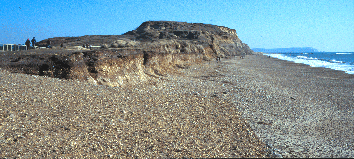
Hengistbury Head, Dorset,
UK
The listing will
be presented as a database linked to the GIS model. As well as providing
a detailed record of the current understanding of the coastal resource,
it will be used as the base for predictive modelling of potential site
locations under the English Channel.